2. Literature Study#
2.1 Background#
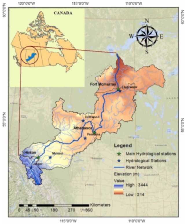
The Lower Athabasca River spans 200km and is located in northern Alberta, Canada. It forms the downstream part of the 1200 km Athabasca River (see Figure 2) originating from Jasper National Park in the Rockies and meets at Fort McMurray (Athabasca Watershed Council, 2026). The river feeds Lake Athabasca and ends up in the McKenzie River further downstream. The river basin is largely influenced by cold region hydrological processes, namely, snow accumulation, snowmelt and to a lesser extent, glacial melt (Kashyap, 2022). In the river basin feeding Fort McMurray, the mean precipitation contribution between 1991-2020 consisted 78% of rainfall and 22% snowfall (Government of Canada, n.d.). This is a decrease in snowfall contribution from 25% between 1981-2010 and 1971-2000, and 28% between 1961-1990 (Government of Canada, n.d.). See Appendix A for a snow cover depletion curve over time. Glacial melt contributes to 3,9% of annual discharge at Hinton, upstream of the Athabasca River and is projected to increase to 5,7% over 2071-2100 under RCP 8.5 (Chernos et al., 2020). As Fort McMurray lies much farther downstream and covers a much larger river basin of 132.000 km2, the relative contribution of glacial melt is expected to be much lower.
Hydrological processes occurring in the LAR are strongly seasonal. Ice cover typically forms along the LAR in early November and remains until late April or early May, when it breaks up due to warming temperatures and snowmelt runoff (Peters et al., 2023). During break up, ice jams can occur which is when a large chunk of ice acts as a temporary dam often leading to rapid, unpredictable streams (Nottawasaga Valley Conservation Authority, 2026). These are most likely to occur farther upstream in narrow mountainous streams. In April 2020, a large ice jam caused severe flooding around Fort McMurray affecting 13.000 people (Canadian Red Cross, n.d.). Although freeze up and break up is not the main focus of this study, they are useful in defining the open water navigation season for which low flow days are analysed (See chapter 3). Ice jams are usually unpredictable and may influence the accuracy of the model used in this study.
Boreal and Taiga regions make up a large part of the Athabasca River Basin which may contain potholes (Ecosystems Classifications Group, 2008). According to D. Eythorsson, these potholes can store water locally, creating non-contributing areas, limiting drainage from snowmelt or precipitation to the receiving rivers (personal communication, 2026). When the potholes are filled, all overflown water will drain into the river. This may introduce conceptual model challenges or errors when not accounted for (personal communication, 2026; Faramarzi et al., 2015).
Finally, the region is also affected by oil sands industries near Fort McMurray who take up to 4,4% of annual water flow to produce Bitumen (Axelrod, J., 2015). Extraction limits are present during low flow conditions (Alberta Environment and Parks, 2026). Current withdrawals are expected to reduce water depth by under 0,02 m (Peters et al., 2023), having very little influence on navigation on the LAR during low flow (Canada, T., 2020) but rather on water quality (Normand, G., et al., 2018).
2.2 Determination of critical threshold#
To analyse low flow navigation constraints, a critical discharge threshold must be defined. Critical depth depends on vessel type, loading condition and local channel bathymetry. The standard of navigation used by indigenous communities is considered a fully loaded vessel (loaded after a hunt or with resources) with a trapping cabin and an outboard motor (Candler et al., 2010). The safe navigational depth for this type of boat is approximated to be 1,2 meters (Candler et al., 2010; Kashyap et al., 2022).
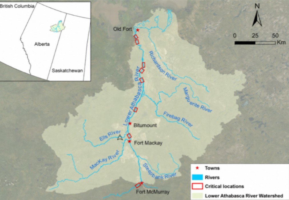
In order to utilise this depth threshold for modelling, a critical discharge must be determined. For this, the Aboriginal Navigational Index (ANI) is used. The ANI links discharge at Fort McMurray to navigation conditions along the Lower Athabasca River by evaluating water depths at known critical navigation sites (Kashyap et al., 2022). Transport Canada investigated the 200 km reach between Fort McMurray and Embarras Portage, selecting 11 high risk sites for detailed field survey (2020). These were selected from a larger set of 35 concern sites identified through indigenous consultation and channel characteristics (Transport Canada, 2020). As a result, it was found that at a critical discharge of 500 m3/s at Fort McMurray, 8 of 11 sites experienced water depths below 1,2 m (See Figure 3 for a location of the 8 critical sites). Besides these critical sites, low flow may be experienced in distributary channels too. This threshold is also supported by the Mikisew Cree First Nation who stated navigation is significantly hindered between 450-500 m3/s at Fort McMurray (2016).
The critical threshold for this study is therefore taken to be:
\(Q_{critical}=500 [m^3/s]\)